Aerial Mapping
Aerial mapping gives you a new perspective of your business.
Whether for a work site, agricultural field, solar farm or other project, Advanced Aerial Solutions provides comprehensive aerial mapping solutions. Our real-time data offers a complete overview of your entire site, allowing you to make accurate decisions and see exactly what’s happening.
What is Aerial Mapping?
Aerial mapping is a technique that uses unmanned drones to capture photographs and measurements from above. Depending on the project, aerial mapping can be used to create photos and 3D models of everything from infrastructure and buildings to mining sites and large areas of land. Where mapping used to involve complex measurements and work on the ground, drones can be used to safely, quickly and cost-effectively map large areas and difficult access sites.
The strength of aerial mapping lies in the post-processing software we use. Modern AI means Advanced Aerial Solutions can process drone photography and videos to create 3D models and to show accurate measurements, elevations, volumes and other detailed information your project needs.
How Aerial Mapping Works
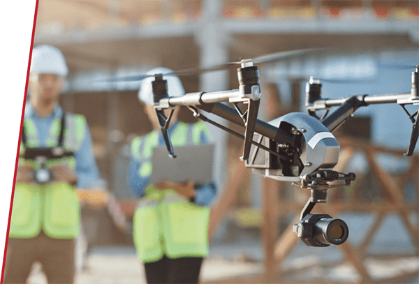
The drones we use for aerial mapping can be equipped with cameras, 3D laser scanners and thermal imaging technology. Our licensed operators establish control points across the area we’re mapping, and then perform drone flights to capture the images we need.
Each drone flight takes hundreds of high-resolution images that can be used to create maps. These images are processed by cutting edge AI that stitches the photos together, creating detailed photographs, videos and 3D models. With the addition of infrared and thermal imaging, Advanced Aerial Solutions can easily highlight key features like roads, rail corridors, crops and property boundaries.
Benefits of Aerial Mapping
The Advanced Aerial Solutions team provides comprehensive aerial mapping services. Our drones can capture images and create models of everything from small structures to large pieces of land quickly and cost-effectively. Drones are especially suited for mapping areas that need regular monitoring or are difficult to access from the ground.
We work with clients from a broad range of industries, including:
- Agriculture. Aerial mapping is an affordable way to regularly monitor crop yield and watch for signs of stress, disease and pests.
- Mining. Monitor mine sites and excavation works in real time and back up your decision making with volumetric stockpile management.
- Construction. Drone imaging is perfect for tracking everything from delicate restorations to large-scale construction and development projects that rely on detailed aerial information.
- Government. We supply government organisations with information for construction and maintenance projects, as well as data for emergency response teams and disaster mapping.
- Forestry. We can quickly develop regular forestry maps that track crop growth, detect disease and monitor the health of trees with the help of infrared cameras.
Contact Advanced Aerial Solutions for Aerial Mapping Services
Aerial mapping is at the cutting edge of what modern drone technology is capable of. Advanced Aerial Solutions can use our equipment to quickly and efficiently map even the largest areas, providing accurate data that helps you stay on top of what’s happening on your site. Contact us today to find out how our aerial mapping team can help your next project.
Drone mapping uses specialist cameras to record images or videos of an area that can be analysed to obtain accurate data for creating maps and 3D models.
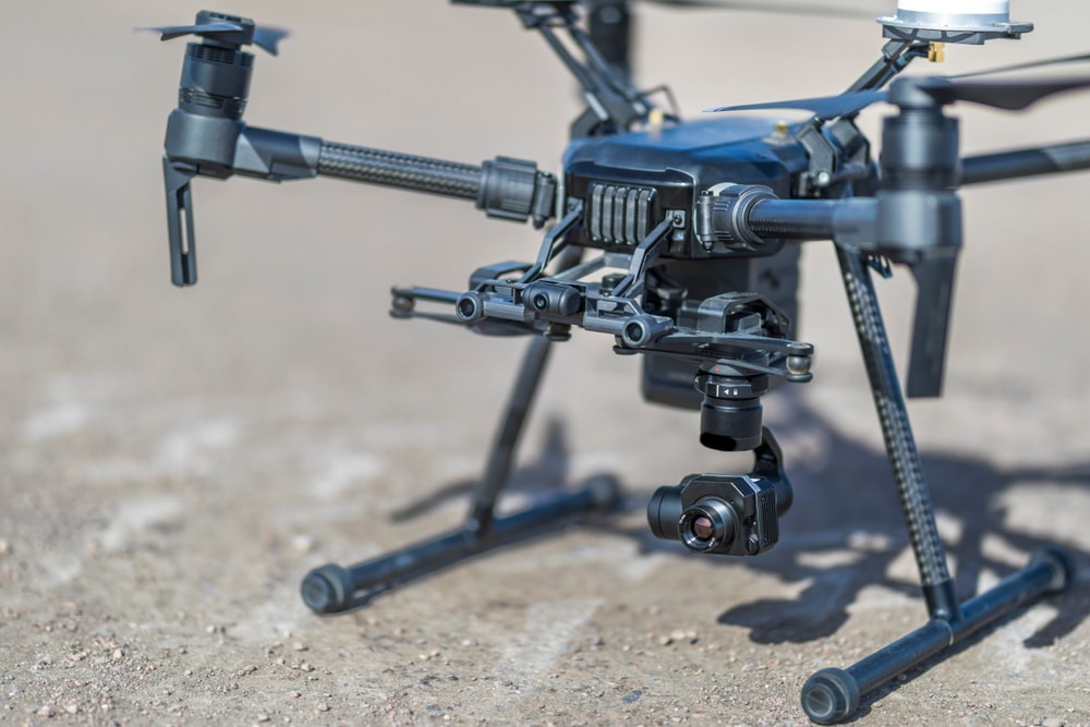
Aerial mapping drones can be equipped with a range of technologies, including standard cameras (for photogrammetry), thermal cameras and LiDAR sensors.
Clear ground can be measured using aerial photogrammetry to an accuracy of approximate 1/8,000th of height from which the images were captured. This typically leads to tolerances of just a few centimetres.
Aerial imagery can be used for a range of tasks, including creating topographical maps, interpreting objects and features, and collecting information for agriculture, forestry, conservation and urban planning.
Aerial photography captures static images and uses no post-processing to make the scale uniform. Aerial mapping uses advanced technology and software to create orthogonal projections and esure the scale of the map is uniform throughout.
Why use a drone to capture this data?
Accuracy
The video and camera quality in drones allows us to look at expansive areas in greater detail. Combined with the reliability of GPS and RTK, using a drone to capture your data will lead to significant benefits and help you see what you may have missed using other methods.
Health and safety
Collecting valuable data doesn’t need to be an OH&S risk anymore. Drones can now be used in these situations where the more traditional methods may have placed your team in harm's way. Data can be captured easily from the air with limited health and safety concerns.
Location
Drones make it much easier to access more places and locations than before. Whether it be towers, masts, roofs, tall buildings, or wind turbines — drones will be able to access the area, provide a different perspective, capture the data and zoom in to specific areas with ease.
Reduce field time and survey costs
Drones have relatively low overheads and are significantly more affordable when compared to the alternatives of manned aircraft. The more efficient choice, drones can be launched and start collecting valuable information much faster than a lot of the alternatives.
Unlock better insights.
Get started with a free 30 minute consultation.
